This is one of a series of four self-guided tours across Shetland in search of the filming locations that have graced our screens, inspiring people to visit the isles. This time we explore the locations used in Shetland's South Mainland.

From Lerwick, take the south road through Sound, passing Tesco and Clickimin Broch onto the A970 towards Sumburgh.

Shetland's South Mainland is a long, narrow, sweeping peninsula that runs twenty-five miles south from Lerwick. The A970, Shetland's artery road that runs north to south, heads to Sumburgh Airport at the southernmost point of Mainland Shetland.

Fladdabister

Seven miles south of Lerwick is Fladdabister, the first destination on the murder trail. Fladdabister has been inhabited since prehistoric times and takes its name from the Old Norse language previously spoken in Shetland – meaning the 'flat farm'.

The community is on the east side of the South Mainland and looks out across the North Sea. Seven miles south of Lerwick, turn off the main A970, signposted Fladdabister. This is a single-carriageway loop road that comes out at Cunningsburgh a few miles south.

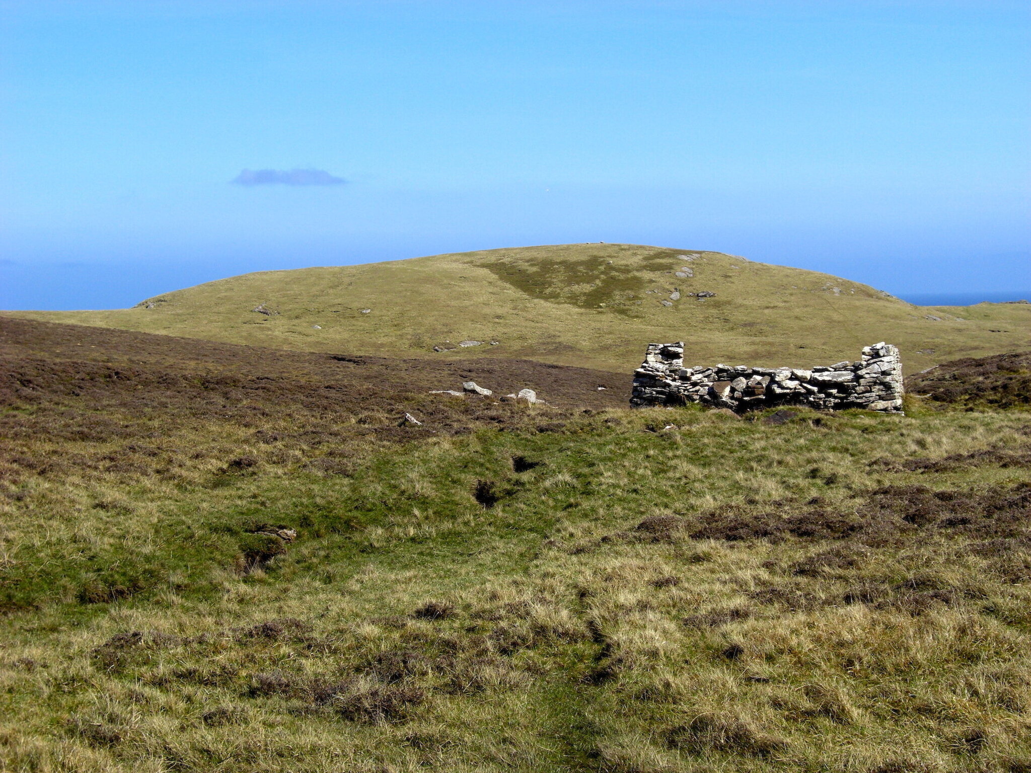
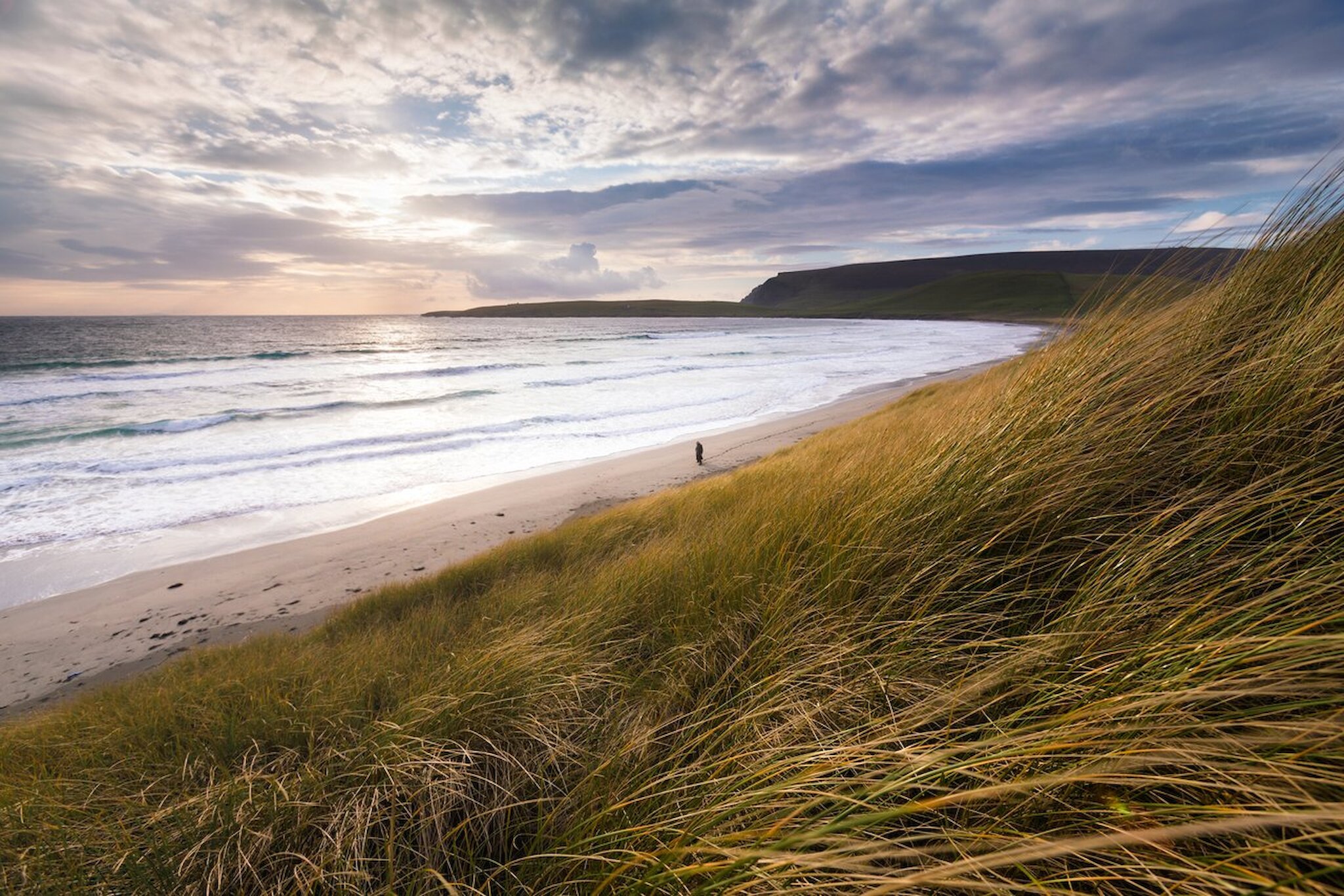
Follow the road for around a mile, dropping down the brae into Fladdabister itself. As you come to the corner before the downhill, you'll enjoy excellent views across to the island of Bressay and several picturesque abandoned houses with commanding views out to sea. This fascinating seascape gives a good indication of Shetland's coastline as a whole – with its numerous 'indents' and geos. The coastline itself is some 1,000 miles (1,700 km) long!

As the ground levels off at the foot of the valley, you'll pass a layby with interpretation panels after the beautiful ruins of a crofting township. Stop here and take a walk towards the lime kilns depicted on the interpretation boards.

Fladdabister is a fertile limestone valley. The lime here was quarried throughout the 19th century and sold for use in the building trade and as fertiliser to improve peaty, acidic soils – prevalent throughout Shetland. Between 30 and 40 barrels of lime were harvested each year. Quarried limestone was burnt between layers of peat to extract the lime – you can see the areas around the kilns have been extensively quarried.

The lime kilns at Fladdabister were used during series three – this is where a dead body was found.

During the 19th century, Shetland was very much an economy of subsistence crofters and fishermen. It was a barter economy where tenants paid their landlords using goods such as knitwear and fish. In exchange, the value – set by the laird – was offset against the tenant's rent. Through this barter system, they could also obtain 'luxury goods' such as tea and sugar from the laird's shop. It was more or less a cashless economy – and one that very much lay in favour of the landlord who controlled the market and prices. The sale of barrels of lime would have provided a welcome cash bonus to the cash-poor crofters who lived in the area here.

Throughout the summer, the road verges are awash with a stunning array of wildflowers that spring up in the fertile limestone ground – so beautiful is this scene that it inspired local poet Rhoda Bulter's poem, Fladdabister.

Aithsetter and Cunningsburgh

After driving the two miles through Fladdabister, you'll reach a junction at the north end of Cunningsburgh. Take the road to the left towards Aithsetter (pronounced Aister). Follow the single carriageway road for several miles, heading in a southerly direction. Up to the right is the main village of Cunningsburgh, which the main A970 passes through.

The central area at the foot of the valley below Cunningsburgh was once the most productive hay meadows in Shetland. Today, it is an area of Special Scientific Interest (SSSI) protected and monitored for its wildflowers that grow in the rich sandstone soils.

The area here will also be recognisable from the Shetland series. Many scenic shots were filmed here, and one of the modern wooden houses was used as a filming location – you'll pass it in the car as you continue south, but remember, this is a residential property, so visitors can't access the house or grounds. I'll give you a clue as to where to find it. As you pass a cluster of modern homes, there is a row of brightly coloured single-storey wooden dwellings on the right, and, as you turn the bend, there's a large two-storey wooden house on the left. This was a filming location.

Sandsayre

At the end of the road, join the A970 once more, turning left towards Sumburgh, rejoining the main road on the south side of Cunningsburgh. Head south for a mile and take the junction on the left towards Sandwick and Hoswick.

About half a mile down the road, follow the road signs to the left towards Mousa Broch and Leebotten. The Sandsayre Pier at the foot of this road is where visitors can take a day or evening tour to the uninhabited island of Mousa. The Mousa Boat operates this service from May to September, and bookings for the day sailings are not necessary but essential in the evening.

The Mousa Boat was used as a filming location in forthcoming season seven, and a trip to the now uninhabited island is a must-see for any visitor to Shetland. The island not only has the best-preserved broch anywhere in Scotland, but it is also home to a breeding colony of storm petrels, and the entire island is a dedicated RSPB Nature Reserve.

Hoswick

From Sandsayre, continue along the road, passing Sandlodge on the left and around towards Hoswick (roughly two miles, following Hoswick Visitor Centre and Cafe signs). Sandlodge was owned by the Bruce family, who were an influential landowning family in the 19th century. There were several attempts at copper mining in the area – largely unsuccessful.

Strictly speaking, Hoswick hasn't featured in the Shetland series, but that's no reason not to visit! The Visitor Centre is an excellent pit stop with an unrivalled selection of homemade cakes and baked goods, as well as a fantastic pick of locally-made gifts, including knitwear.

Maywick

From Hoswick, head back towards Sandwick and take the junction on the left marked A970 South. At the junction to the A970, turn left, heading south and follow this road for a few miles, passing through Channerwick.

As you drive through Channerwick, there are two road signs on either side of the road marking 60°N – Shetland lies at 60° North, where Scotland meets Scandinavia. The latitude line passes through the sweeping South Mainland, metaphorically slicing Shetland in two. Being so far north means that summer days are very long and light – or, as in winter, are very short and dark.

Just beyond Channerwick, take the B9122 towards Bigton, follow the signs towards Bigton and take the junction marked Maywick just before you arrive in Bigton. Before turning towards Maywick, look at the white house on the left-hand side of the road – this house was used in series two as the home of Sally Smith and her family.

Follow the road to Maywick for a few miles, parking responsibly at the end of the road – bearing in mind that this area is used as a turning point. Follow the wooden signs leading between the cluster of houses towards the beach. The beach at Maywick is one of the South Mainland's lesser-explored but no less beautiful areas and was a filming location for the forthcoming seventh series.

St Ninian's Isle

From Maywick, head back towards Bigton, taking a right turn towards Bigton and St Ninian's Isle at the end of the road. Follow the road around and through the village until you reach the sign for St Ninian's Isle. This road passes Bigton Farm, a local farm run by the Budge Sisters of This Farming Life fame and a filming location in series seven.

Park at the beach and enjoy a walk. St Ninian's Isle has been featured throughout the show as a spot for beach parties, drug smuggling and many of the scenic shots. The impressive 500-metre sand tombolo is pristine and expansive, linking St Ninian's island to the Mainland.

Walk to the island and discover the Chapel site where, in 1958, a local schoolboy found a hoard of 9th-century Pictish treasure while assisting archaeologists with a dig on the 12th-century chapel.

If you fancy a longer walk, the island circular is well worth doing, with scenic cliffs and an abundance of wildlife to enjoy along the way.

Clavel (near Rerwick)

Leaving St Ninian's Isle, turn right at the stone gates back on to the road at Bigton (just beyond the farm), pass the community shop – note that there are public facilities here if you need a pit-stop!

At the junction, rejoin the B9122, turning right (note there is no road sign to mark the way here). Follow the road for about a mile until you reach a small stone bridge that the road passes over. Pull over in the layby before the bridge, just as the road narrows to a single carriageway. Here, looking to the right, over the rolling green farmland, sits the remains of a traditional crofthouse called Clavel.

Clavel was the site of one of the shootings in season three, and this area has featured heavily in the imagery that accompanies the show. Clavel, in many respects, is typical of the buildings you will see 'abandoned' in Shetland. Many visitors will ask why there are so many derelict houses, and the reasons for this are complex. But, in simple terms, the occupants moved on at some stage in history, and the buildings were left as they stood.

Clavel and other houses like this that you see in the landscape are traditional but-an’-ben houses; single-storey, two-room houses with adjacent byre and barn. They were traditional in Shetland right into the 20th century and are stylistically similar to the Viking or Norse longhouses that came with the arrival of the Vikings from the 9th century.

Most of these croft houses have been abandoned as their occupants built new homes; larger, modern spaces with insulation, piped water and room to accommodate growing families. After this, the old family homes were left disused – becoming shrine-like, as the only tangible thing remaining from the long-forgotten faces of a family tree. These homes were small and compact, built onto the very hill that they stood, with neither foundation nor any concept that one day, the inhabitants might want a bathroom, a home office or a utility room. By nature, they were damp, drafty and crowded, yet they evoke nostalgia as immeasurable as the passing of time through their walls.

Clavel was laterally the home of the late James Robert Sinclair, who was born there in 1930. He lived there till 2007 when he moved into the fold of the community in Bigton. You can watch a short video featuring James Robert Sinclair of Clavel by Shona Main.

Scousburgh Sands

Continuing along this road in a southerly direction, just around the corner from Clavel, is the Rerwick Beach (pronounced Rur'ick) – pull over here and look down at the white sand from the layby above. Do you see any seals? They often haul up here as the beach is relatively quiet with few (if any) visitors, other than the local rowing team who launch from here.

Continue from Rerwick for a couple of miles until you reach a junction marked Spiggie. This road passes the Spiggie Hotel used throughout the series – mainly as a place where the show's stars warmed up after a cold spell in the sea on the Scousburgh Sands.

Originally Spiggie Hotel offered the perfect 'Victorian retreat', away from the hustle and bustle of city life. These breaks attracted wealthy visitors who would travel by 'steamer' from Leith and disembark at the beach. Whilst at Spiggie, the gentlemen, would hunt and shoot seals or fish for trout in the nearby Spiggie Loch. For the ladies, days were spent leisurely reading, playing music and embroidering. Guests would expect to spend a week or two recharging before taking the steamer to another destination.

About half a mile down the road from the hotel, follow the sign for Scousburgh Sands (Spiggie Beach), taking the rough track to the right. The Spiggie Loch behind the beach is a freshwater lagoon formed where a seawater voe once stood. The loch is a fantastic spot for birdwatching, attracting plenty of wading and migratory birds. The loch is also a mecca for anglers, and fishing permits are easily bought through the Shetland Anglers Association.

Scousburgh Sands is a beautiful beach to walk along, and it was used as a filming location for the Shetland show – particularly in series five, where it was the scene of several 'discoveries'. Geologically it's interesting as it was formed by a mid-bay bar that grew close to the end of a long voe, eventually cutting off the voe and forming a dune and machair system. This north-facing beach looks across to Rerwick and is a popular place to swim.

Peerie Spiggie

Returning from the beach – with sandy toes, I hope – continue along the road you came off to reach the beach. A few hundred yards along here, you'll get to another small beach – be careful not to miss it as it's unmarked. Look for a small stone booth or shed on the right and a few boats hauled up. Pull in here, making sure not to obstruct the gate, and follow the path through the gate towards the beach.

Peerie – meaning small – Spiggie is another filming location. This spot is where Perez gave student Hattie some 'fatherly' advice in series one. Visually, the beach is a stunning location, awash with wildflowers in the summer, geologically exciting and an important place to keep boats in the past. Look above the beach where there are a few wooden boats hauled up; you'll note hollows or depressions in the ground – count them – these are where boats, at one time, were pulled up and battened down over the winter to keep them safe from storms. How many of these noosts can you see?

Quendale

From here, we're heading a few miles south towards Quendale. We're still on narrow single-track roads, so enjoy the leisurely and meandering drive south. Continue along the road in a southerly direction from Peerie Spiggie, skirting the Spiggie Loch, an RSPB Nature Reserve. Follow this unclassified road for several miles, passing through rolling farmland with cattle and sheep until you reach a junction with a sign pointing you 'right' towards Quendale Water Mill. Follow the signs for a mile-and-a-half until you reach Quendale Mill.

Quendale Mill dates to around 1867 when the estate lairds commissioned the building of this mill – now run as a museum and local history centre. Its purpose was to mill the grain for crofters in the South Mainland and was one of only two substantial mills on the mainland (the other being Weisdale Mill, now run as an art gallery and cafe called Bonhoga in Shetland's West Mainland).

Quendale Farm was used for filming for the seventh series – so we'll have to wait and see what dramas unfold here!

The nearby Quendale beach is the longest stretch of sand in Shetland, at a mile-long – it's a great place to stretch those legs.

Sumburgh Hotel

From here, we're going to hotfoot it down to Sumburgh, the most southerly point of Mainland Shetland, as it must be beyond lunchtime by now? Follow the road you arrived via and follow it towards the main A970 (don't take the junction back towards Spiggie). There are few road signs along here – follow the road back, heading east towards the A970.

Before you rejoin the A970, you reach Mainlands Shop, where fuel is available if the tank is running dry. At the junction, take the A970 south (turning right) towards Sumburgh and follow it for four miles. As you approach Sumburgh, there are fantastic views of the airport and runways, as well as Sumburgh Head, where the lighthouse stands proud. Look out to the south (up ahead and slightly to the right) and scan the horizon. If the day is clear, the island of Fair Isle is sometimes visible on the horizon – you'll remember this as the ancestral home of Jimmy Perez.

Fair Isle sits about 25 miles south of Shetland and is home to around 50 islanders. Today, Fair Isle is owned by the National Trust for Scotland and is a popular destination for knitters and birdwatchers.

One of the novelties of this drive is that you have to pass over the islands' runway. The east-west runway terminates in the North Sea to the left (as you're driving south) and the North Atlantic to the right.

About a mile from the airport, follow the signs towards the Sumburgh Hotel and stop for a well-deserved break. The hotel serves lunches and tea or coffee and was used as the care home in series two.

Sumburgh Head

Another option for lunch, incredible views, showstopping cakes and another filming location is Katya's Unken Kafee at Sumburgh Head Lighthouse. This location was used as a hotel in the series when Willow Reeves stayed there during the investigations and is an excellent place to stop, explore and stuff yourself with German-inspired cakes and bakes.

From Sumburgh Hotel, follow the road south for a mile-and-a-half, towards the lighthouse – you can't miss it! Park in the car park and walk up to the complex of buildings.

The lighthouse dominates the headland and has played an essential role in Shetland for generations. It was built by the famous 'lighthouse' Stevenson family and completed in 1821. A keeper and his family lived in the lighthouse until the light was automated in 1991.

During the Second World War, Sumburgh Head played a prominent role as an early warning radar station, warning of any Nazi movements in the North Sea area. On 8th April 1940, Sumburgh's radar station arguably changed the course of the war as they intercepted a massive Nazi attack on the British fleet at anchor in Scapa Flow, Orkney.

Today, the lighthouse keeper's accommodation and the outlying buildings are part of a complex managed by Shetland Amenity Trust. Visitors can explore a Marine Life Centre, gift shop, Smiddy and recreated Radar Hut. The site is also home to the RSPB, who monitor the marine life in the area and across Shetland as a whole.

Sumburgh Head is home to an array of breeding seabirds, including; guillemots, shags, fulmars, kittiwakes and puffins. Gannets, great skuas and terns can also be seen feeding in the rich fishing waters around the Head.

Levenwick

You thought we'd reached the end of the line? We have indeed run out of road, but there's still more to explore.

As you head back north, remain on the main A970 north for ten miles towards Levenwick. This community is another area with a stunning sandy beach and picturesque village that has played its part in the Shetland TV series.

The drive back to Lerwick from here is much quicker as we can follow the main road back – remember, heading south, we meandered along every backroad and scenic spot along the way!

We hope you've enjoyed this tour of Shetland's scenic South Mainland that has inspired so much of the show over the years.